Tuesday, September 29, 2020

Catch My Fall

 Tellico Gap, NC to Stecoah Gap, NC

AT miles hiked - 150.6

AT miles to go - 2,042.4

Friday, September 25th, I took a planned zero day.  The weather forecast called for rain off and on all day, so it turned out to be a good day for a zero.  After breakfast, I actually drove back home so I could pick up my colder weather down mummy bag.  It looks like the nighttime temps will be getting past the rating of my down quilt, especially in the Smokies, and I want to stay warm.  I had also purchased a pair of down "socks" or booties from a small gear company in Gainesville, GA which just happened to be right on my route home.  Hopefully, now I won't have to worry about cold feet at night.  I had lunch with Marci, did some grocery shopping, took the dogs for a walk and then headed back to the hostel in Franklin, NC.

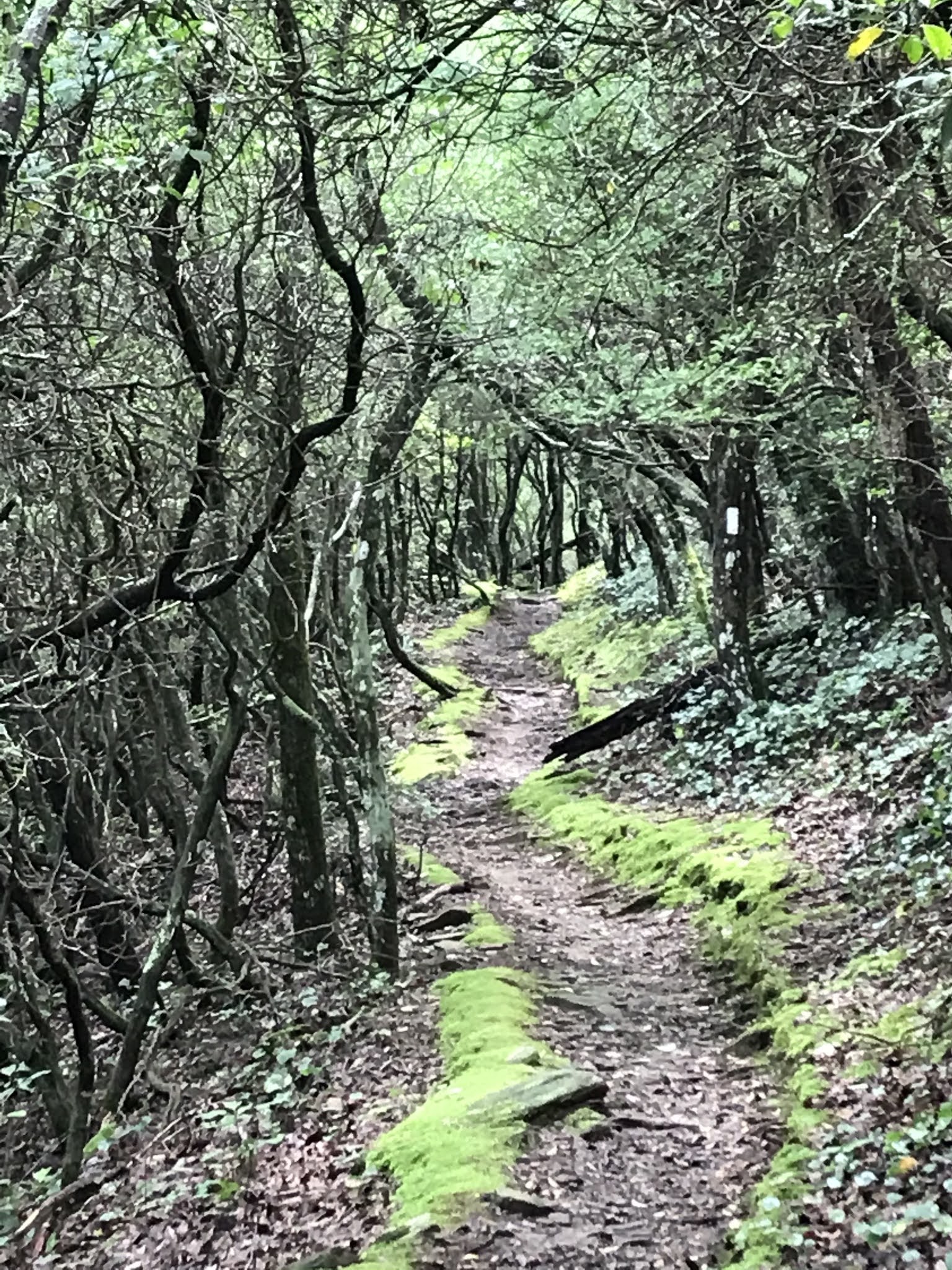
Saturday morning, Sunsets drove me back to Tellico Gap and I was, again, headed northbound about 8:40.  As always, since the trailheads seem to be in gaps, the first mile plus was a climb - this time to Wesser Bald and the lookout tower located on the summit.  It was not a bad climb and, although it was quite cloudy and overcast, there was still a beautiful view to be had.  The rest of the hike was mostly down hill, several thousand feet of elevation, to the Nantahala Outdoor Center (NOC) and the bridge crossing the Nantahala river.  I arrived there just after 1:00 pm.  Since it was the weekend, the place was pretty busy and crowded with people.  I ordered a sandwich from the River's End restaurant and was waiting for my order when Sunsets arrived to shuttle me back to the hostel.  Dinner for the evening was some delicious Mexican food from the Mi Casa restaurant in Franklin.

Panoramic view from Wesser Bald lookout tower.

On top of Wesser Bald lookout tower.

Descending into the "land of the midday sun."

Fall colors appearing.


Crossing the bridge over the Nantahala River.

Sunday was another zero day so I could relocate my "base" to "Hawk's Hiker Haven" in Stecoah.  I left Chica & Sunsets mid-morning and drove to Stecoah where I got settled into my next hostel.  It's a small, one room cabin with a set of bunk beds, a futon, shower, toilet, sink, microwave, toaster and small fridge.  Not much in the way of luxuries, but just what a hiker needs to be comfortable.

Saying goodbye to Chica & Sunsets.

Hawk's Hiker Haven, Stecoah, NC.

My base for the next section.

Monday morning, September 28th, Craig, the owner of the hostel, shuttled me to the Stecoah Gap trailhead.  I had chosen to do this next section SOBO from Stecoah Gap, up over Cheoah Bald and down to the NOC so as to avoid the long, long, long climb out of the Nantahala River gorge.  It was still almost a six mile climb to the summit of Cheoah Bald.  I had planned to do this section of just under 14 miles as an overnight, staying in the Sassafras Gap shelter.  However, I was feeling strong during the climb, and with the forecast calling for rain later in the day and overnight, I decided I was going to do the whole section in one day.  After summiting Cheoah, I had a short break to eat a late lunch and then headed down.  Just short of the shelter, I had my first fall.  In the blink of an eye, I stepped on something wrong, rolled my right ankle, and landed on my hands and left knee.  My first thought was, "Maybe I'll be staying in the shelter tonight after all!"  But I was able to shake it off and after a few moments of pain and annoyance I was headed SOBO again.  At the side trail to the shelter, I tied my shoe tighter and downed a few vitamin-I (ibuprofen).  From the shelter, it was almost eight miles of steep down hill.  I arrived at the NOC for the second time about 6:15 pm, grabbed two cokes and a microwave biscuit sandwich from the General Store and waited for Craig to pick me up.  Total mileage for the day was 13.81 and I was glad to be in a cozy bed for the night.

My first sighting of a red Eastern Newt.

On the summit of Cheoah Bald.


Looking down into the Nantahala River gorge from the "Jump Up."

It rained all night and Tuesday turned out to be the perfect day to take another zero.  It rained heavily during the morning and off and on all day.  I drove home to do laundry and have lunch with Marci and was back at the hostel about 6:30 pm.


"Catch My Fall" - Billy Idol

Friday, September 25, 2020

Hotel California

 Deep Gap, NC to Tellico Gap, NC

AT miles hiked - 128.8

AT miles to go - 2,064.2

Saturday evening, September 19th, I drove to Franklin, NC and checked into Chica & Sunsets AT Hostel which I now affectionately think of as the "Hotel California."  If you are like me, once you check in to this place, you'll never want to leave.  Chica & Sunsets (Jen & Greg Seymour) thru-hiked the AT in 2017.  This year they opened their hostel in Franklin, NC and they sure know what they are doing.  It's a small hostel which can accomodate up to 4 hikers and has everything a hiker could want.  They have been fabulous hosts and I've thoroughly enjoyed my time here.

On Sunday morning, Sunsets dropped me off at the Deep Gap, NC trailhead.  The weather was perfect for hiking - cool and sunny and I made the 2.5 mile/1,000 foot climb to the summit of Standing Indian Mountain without stopping once.  What a difference the weather has made!  I'm no longer dreading the climbs.  My hike that day was about 8.5 miles and I arrived at Carter Gap Shelter where I made camp for the night.  I was joined there by "Jabez," a 2019 thru-hiker from Ohio who was back doing a section in this area.  He had also stayed the night before at Chica & Sunsets and was hiking southbound while I was hiking northbound.

On the summit of Standing Indian Mountain.


A view from Standing Indian Mountain.


With "Jabez" at Carter Gap Shelter.

A water source.


Sunday night the temperature dropped to 42 degrees and the wind was blowing strong high in the trees.  I was warm enough except for my feet which ended up with two pairs of wool socks and then stuck inside my down puffy in the footbox of my sleeping quilt.  I've been using a 20 degree quilt but I think I'll need to change to my colder weather sleeping bag before I get into the Smokies.  Monday morning Jabez and I parted ways and I was back on the trail northbound at 8:00 am.  It was quite breezy all day but still very pleasant hiking weather.  While on the trail I met two fellow Amateur Radio operators who were out for some Summits on the Air (SOTA) activations.  We had a pleasant chat before heading our respective ways.  The highlight of the day was the climb to the Albert Mountain fire tower and the 100 mile mark on the AT.  The last 0.2 miles was almost hand-over-hand, but the view from  the summit was fantastic.  I finished the day at the Long Branch Shelter for total hike of about 9 miles.

Panoramic view from the Albert Mountain fire tower.

With K2JB (Dean Blair) on the AT.

And KW4JM (Scott Carter) on the AT.


Hand-over-hand climb to Albert Mt.

100 miles of the AT completed!!


Tuesday was another beautiful day for hiking.  The weather the night before was night as cold and I managed to sleep off and on.  I was back on trail at 8:00 am for a hike just over 7 miles to Winding Stair Gap on NC highway 64.  Again the weather was sunny, cool and pleasant.  There was one decent view through the trees towards Franklin, NC but most of the hike was typical Southern Appalachian forest.  Sunsets arrived at Winding Stair Gap just as I was coming down the last log steps and shuttled me back to their wonderful hostel.  I showered, ate a frozen pizza, did laundry, resupplied at the grocery store and had a great burger from Motor Company Grill for dinner.  I had planned to take a zero day on Wednesday, but since the weather looking great and rain was moving in later in the week, I decided to hike another two days before zeroing.


I had a great night's sleep at the hostel and, after breakfast, Sunsets shuttled me back to Winding Stair Gap and I was on trail by 8:20 headed north.  I first had a 4.3 mile/3 Jolly Ranchers climb to the summit of Siler Bald.  The view was almost 360 degrees and I could see Wine Spring Bald and Wayah Bald which I would be climbing next.  I took a short break at the summit and ate "elevensies" before heading back down the trail.  I arrived at the summit of Wayah Bald and the historic lookout tower there about 3:00 and again enjoyed wonderful views and a nice break.  My final destination for the day was Wayah Shelter for a total of 11.5 miles hiked.  It looked like I was going to have the shelter to myself and, since rain was in the forecast, I set my sleep system up in the shelter, ate dinner and hung my bear bag.  Just as it got dark, a couple who were hiking SOBO arrived and kept me company for the night.  It rained off an on all night, but I slept the best I have on trail yet.

Trail near summit of Siler Bald.

View of Wayah Bald from Siler Bald.

Enjoying a break on Siler Bald.


At the historic Wayah Bald tower.

Taking a break at Wayah Bald.


Thursday was a wet morning, although at first it was mostly the water dripping from the trees.  I wasn't worried about getting wet though as I was headed back into town for the night.  I hiked 8.5 miles to Tellico Gap and didn't pass any other hikers until just before reaching the trailhead.  As I was hiking down to Burningtown Gap (the last gap before my destination) I saw a parked vehicle with a canopy set up just behind it.  I suddenly, irrationally, started getting excited thinkg maybe some "trail magic" was about to appear.  Alas, it was simply two locals who had camped there under the canopy.  Oh well.  I ate a candy bar instead and continued on my way.  About a mile before reaching Tellico Gap it started to rain heavily.  I was already pretty wet, but I pulled out my backpacking umbrella for the first time since March and managed to keep the rain out of my face.  I was pretty cold and wet by the time Sunsets arrived to pick me up but quickly warmed up after getting into the car.  Had a delicious burrito and chile poblano from a Mexican restaurant in town and looked forward to my zero day on Friday. 

It's not Cracker Barrel but it does the job.

Bed for the night at Wayah Shelter.

Trying to stay dry at Tellico Gap.


"Hotel California" - Eagles


Sunday, September 13, 2020

Ramblin' Man

 Hogpen Gap, GA to Deep Gap, NC

AT miles hiked - 85

AT miles to go - 2,108

One state down, thirteen to go! I finished Georgia on Saturday, September 12th.  Not much of an accomplishment in the grand scheme, but the way this year has gone I feel like celebrating every little milestone.  So - Georgia done!

On Monday, July 27th, I completed my longest single day on the AT so far.  I had planned to do the hike from Hogpen Gap to Unicoi Gap as an overnighter, but I was feeling strong and managed to complete the entire hike in one long day. 14.58 miles.  I didn't take any pictures that day as the trail was pretty blah, no views to speak of, and the weather was very humid and overcast.  Towards the end, I had to hike through a miserably rocky section coming down Blue Mountain which felt like training for "Rocksylvania."

My next section was an overnighter from Unicoi Gap to Dicks Creek Gap, Tuesday and Wednesday, August 4th and 5th.  My nephew Brandon accompanied me on this hike which made it very enjoyable.  I've learned that as much as I thought I would cherish the solitude of a long hike, I much prefer having hiking partners.  Brandon enjoyed his recent hikes so much that after our return he managed to score a permit to hike the John Muir Trail at the last minute and just completed that hike.  Brandon and I started at Unicoi Gap and hiked just under six miles to the Tray Mountain shelter.  We set up our tents and had dinner before a big thunderstorm moved in.  The campsites were very flat and well used which prevented them from draining very well.  Before long, we had about an inch of water covering the sites and our tent floors were eventually going to soak through.  So, during a break in the rain we gathered all our gear from the tents and moved into the shelter where we spent the night.  There was one other hiker also tenting near the shelter who arrived just before us.  "Mayor" had thru-hiked the AT in 2019 and we enjoyed hearing about his experience and advice.  The following day, we hiked 11.6 miles from Tray Mountain Shelter to Dicks Creek Gap.

View on the way to Tray Mountain.

The trail along Tray Mountain.


As I mentioned in the previous blog post, I took a hiatus from the AT while Marci and I drove out to Utah and back.  On Friday, September 11th, I resumed my AT hike.  This time I hiked from Deep Gap, NC south to Bly Gap on the NC/GA border.  I camped at Bly Gap and was joined there by "Noodles" and "Long Skirt," a very experienced hiking couple from Florida.  Noodles has hiked the PCT, the CDT, the AT and five different Caminos, along with a host of other hikes he told me about.  I really enjoyed my evening with them.  We had expected a possible thunderstorm all day and maybe overnight, but fortunately the rain did not come until the next morning.  Noodles and Long Skirt were headed northbound while I continued south.  I chose to do this hike southbound so as to favor the descents rather than ascents (which I still loath).  I set out at dawn on a very misty and overcast morning.  Just past my campsite I crossed the NC/GA border.  Later in the morning it started raining pretty heavily.  Since it was still very warm I didn't bother with my rain gear or umbrella and just got soaked instead.  I arrived at Dicks Creek Gap at 1:40 pm where my trail angel wife picked me up and I was glad to have completed my first state on the AT.  Only 13 more to go!

Shouldn't it be the "Chunky Guy" trail?

The famous Oak tree at Bly Gap.

Campsite at Bly Gap

Looking like a deer in the headlights at the NC/GA border.


"Ramblin' Man" - The Allman Brothers Band.

Thursday, September 3, 2020

Where Eagles Dare

Wasatch and Uinta Mountains hikes.

I took a break from my slow progress on the Appalachian Trail so that Marci and I could drive crosscountry to return Erin to BYU and visit with Marci's family in Utah.  While in Utah, I couldn't  pass up the opportunity for some hikes in the Wasatch and Uinta Mountains.

On Friday, August 28th, Erin and I hiked to Stewart Falls in the Wasatch Mountains not far from the Sundance ski resort.  We were accompanied by my niece-in-law, Macie, who is hanging out in Utah while her husband (my nephew) Brandon is hiking the John Muir Trail in California.  The Stewart Falls trail starts at the Aspen Grove trailhead and ascends gradually before descending to the base of a beautiful cascade.  The hike was just under four miles.  We had fantastic weather and really enjoyed the hike with Macie.

On the trail to Stewart Falls with Erin.

Erin and Macie.

Stewart Falls

The "high and beautiful" Uinta Mountains are one of only three mountain ranges in the Western hemisphere which run East/West.  The Uinta Highline Trail is on my bucket list of trails to thru-hike some day.  The Highline Trail traverses the entire range and is about 108 miles in length with an average elevation of 10,700 feet.  I didn't have time to attempt a thru-hike on this trip, nor was I prepared to attempt it on my own yet.  However, I wanted to experience a piece of the trail.  On Monday, August 31st, I completed a very pleasant day hike which started at the Hayden Pass Trailhead, the western terminus for the Highline Trail.  I hiked several miles on the Highline and then took a side trail to Wilder, Wyman and Packard lakes - three beautiful alpine lakes in the Uinta Wilderness.  The highlight of the trail for me was the unexpected terminus near Packard Lake right on the edge of a canyon overlooking the East Fork of the Duchesne river.  Again the weather was great and the 8.5 mile hike just convinced me even more that I need to hike the entire Highline Trail one of these days!

Panoramic view of Wyman Lake.

En route to Hayden Pass.

Packard Lake & Mount Agassiz.

East Fork of the Duchesne River canyon.


Where Eagles Dare - Iron Maiden